
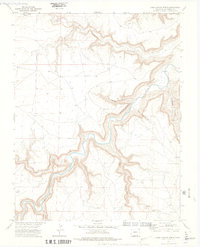
1972 Map of Doss Canyon North
USGS Topo · Published 1975About this map
The Purgatoire River carves a deep, winding path through this corner of Las Animas County, serving as the dominant geographic force in a landscape defined by dramatic erosion. In the early 1970s, this area remained largely undeveloped, characterized by a complex network of drainage systems including Lockwood Canyon and Doss Canyon. The small settlement of Waller sits on the eastern plateau, providing a rare point of human habitation in a region primarily navigated by a Jeep Trail and a remote Landing Strip.
Find a feature on this map
14 named features on this map. Tap any name to fly to it.
Don’t see what you’re looking for? This feature index may not catch every label — zoom into the map to look around manually.
Map Details
Editions of this 1972 Doss Canyon North Map
4 editions found
Other maps of this area

1891 · Timpas
USGS Topo · 1:125,000

1891 · Mesa De Maya
USGS Topo · 1:125,000

1893 · Mesa de Maya
USGS Topo · 1:125,000

1894 · Timpas
USGS Topo · 1:125,000

1955 · La Junta
USGS Topo · 1:250,000

1958 · La Junta
USGS Topo · 1:250,000

1968 · La Junta
USGS Topo · 1:250,000

1972 · Johnson Canyon
USGS Topo · 1:24,000

1972 · Doss Canyon South
USGS Topo · 1:24,000
1972 · Painted Canyon
USGS Topo · 1:24,000