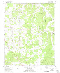
1981 Map of Doss
USGS Topo · Published 1981About this map
The rugged topography of the Ozarks defines this landscape in Dent County, where the Mark Twain National Forest blankets much of the eastern terrain. Small rural settlements like Doss and Turtle serve as anchor points in a region deeply carved by the Meramec and Spring Creek. The map reveals a history of extraction and resource management, evidenced by Stephens Mine, Riverside Mine, and multiple quarries located near the Meramec River.
Find a feature on this map
38 named features on this map. Tap any name to fly to it.
Don’t see what you’re looking for? This feature index may not catch every label — zoom into the map to look around manually.
Map Details
Editions of this 1981 Doss Map
This is the sole edition of this map. No revisions or reprints were ever made.
Other maps of this area

1932 · Cedar Grove
USGS Topo · 1:48,000

1941 · Salem
USGS Topo · 1:62,500

1941 · Stone Hill
USGS Topo · 1:62,500

1945 · Salem
USGS Topo · 1:62,500

1945 · Stone Hill
USGS Topo · 1:62,500

1945 · Round Spring
USGS Topo · 1:62,500

1947 · Sinkin
USGS Topo · 1:48,000

1949 · Round Spring
USGS Topo · 1:62,500

1949 · Rolla
USGS Topo · 1:250,000

1951 · Cedargrove
USGS Topo · 1:24,000