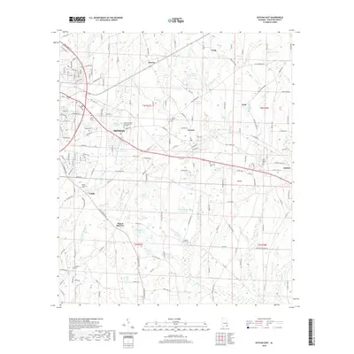
2018 Map of Dothan East
USGS Topo · Published 2018About this map
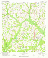
Dothan serves as the focal point for this survey of Houston County, showing the city's eastern expansion toward the neighboring communities of Cowarts and Ashford. The landscape is defined by its agricultural and educational transition, notably featuring the Alabama College of Osteopathic Medicine and the nearby Hurts Chapel Cem. Several small lakes and ponds, such as Jessie Forrester Lake, Porters Lake, and Ingram Lake, are scattered across the terrain, indicating the importance of local water management for both recreation and farming. To the south, the map identifies Wilson Quarters and Ardilla, providing a clear view of the rural-to-suburban shift in this portion of Alabama. Numerous family-named landmarks and local burial grounds like Cowarts Creek Cem and Mount Pleasant Cem offer specific points of interest for genealogists tracing local lineage in the area between Smyrna and Enon.
Find a feature on this map
219 named features on this map. Tap any name to fly to it.
Don’t see what you’re looking for? This feature index may not catch every label — zoom into the map to look around manually.
Map Details
Editions of this 2018 Dothan East Map
This is the sole edition of this map. No revisions or reprints were ever made.
Other maps of this area

1953 · Dothan
USGS Topo · 1:250,000

1954 · Dothan
USGS Topo · 1:250,000

1955 · Dothan
USGS Topo · 1:250,000

1969 · Dothan East
USGS Topo · 1:24,000
1969 · Dothan West
USGS Topo · 1:24,000
1969 · Midland City
USGS Topo · 1:24,000

1969 · Headland
USGS Topo · 1:24,000
1969 · Cottonwood
USGS Topo · 1:24,000
1969 · Madrid
USGS Topo · 1:24,000

1970 · Sigma
USGS Topo · 1:24,000