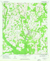
1969 Map of Cottonwood
USGS Topo · Published 1972About this map
The town of Cottonwood serves as the central hub of this late-1960s survey, situated along the Atlanta And Saint Andrews Bay railroad line. This coastal plain landscape in Houston County is defined by its agricultural and religious network, with numerous small congregations like Union Hill Ch, St Marys Ch, and Harpers Joy Ch dotting the countryside. The southern edge of the map follows the Alabama Florida state line and the east-west Base Line, where the terrain shifts into the marshy lowlands of Pittman Bay and the drainage of Spring Creek. Smaller settlements such as Sealy Springs and Hodgesville reflect the rural character of the era. The presence of several family-named landmarks, including Terry Crossroads and Smiths Pond, provides valuable points of reference for local family history and genealogical research.
Find a feature on this map
34 named features on this map. Tap any name to fly to it.
Don’t see what you’re looking for? This feature index may not catch every label — zoom into the map to look around manually.
Map Details
Editions of this 1969 Cottonwood Map
2 editions found
Other maps of this area

1952 · Malone
USGS Topo · 1:24,000

1952 · Campbellton
USGS Topo · 1:24,000

1952 · Sills
USGS Topo · 1:24,000

1953 · Dothan
USGS Topo · 1:250,000

1954 · Dothan
USGS Topo · 1:250,000

1954 · Tallahassee
USGS Topo · 1:250,000

1955 · Dothan
USGS Topo · 1:250,000

1959 · Tallahassee
USGS Topo · 1:250,000

1960 · Tallahassee
USGS Topo · 1:250,000

1969 · Dothan East
USGS Topo · 1:24,000