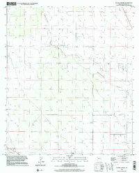
1996 Map of Double Adobe
USGS Topo · Published 2003About this map
Double Adobe serves as the central settlement in this high-desert landscape of Cochise County, where the topography was first compiled in the 1950s. The terrain is defined by the meandering path of Whitewater Draw, which cuts through the valley floor, creating a natural corridor for drainage and sparse desert vegetation. Infrastructure is focused around the Elfrida Cutoff, providing a window into the mid-century road network of southern Arizona.
Find a feature on this map
13 named features on this map. Tap any name to fly to it.
Don’t see what you’re looking for? This feature index may not catch every label — zoom into the map to look around manually.
Map Details
Editions of this 1996 Double Adobe Map
This is the sole edition of this map. No revisions or reprints were ever made.
Other maps of this area

1902 · Bisbee
USGS Topo · 1:62,500

1910 · Bisbee
USGS Topo · 1:62,500

1914 · Douglas
USGS Topo · 1:62,500

1916 · Pearce
USGS Topo · 1:125,000

1916 · Douglas
USGS Topo · 1:125,000

1919 · Douglas
USGS Topo · 1:125,000

1922 · Swisshelm
USGS Topo · 1:62,500

1925 · Douglas
USGS Topo · 1:62,500

1925 · Gleeson
USGS Topo · 1:62,500

1927 · Bisbee
USGS Topo · 1:62,500