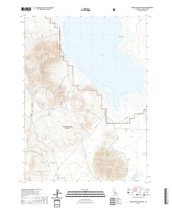
2021 Map of Double Head Mountain
USGS Topo · Published 2021About this map
Modoc National Forest encompasses the high desert terrain of northeastern California, where the prominent Double Head Mtn rises above the surrounding volcanic plateau. This landscape is defined by the expansive waters of the Clear Lake Reservoir, which serves as a critical centerpiece for the Clear Lake National Wildlife Refuge. The map details a complex system of marshes and islands, including Bird Island, along the southern and eastern shores of the reservoir. A unique technological installation, labeled as Oth Radar, sits south of the main peak, indicating the area's modern strategic utility. The topography transitions from the open water and wetlands of the north to the distinctive elevations of the Clear Lake Hills in the west, connected by rugged corridors such as Clear Lake Rd.
Find a feature on this map
17 named features on this map. Tap any name to fly to it.
Don’t see what you’re looking for? This feature index may not catch every label — zoom into the map to look around manually.
Map Details
Editions of this 2021 Double Head Mountain Map
This is the sole edition of this map. No revisions or reprints were ever made.
Other maps of this area

1886 · Modoc Lava Bed
USGS Topo · 1:250,000

1892 · Modoc Lava-Bed
USGS Topo · 1:250,000

1951 · Clear Lake Reservoir
USGS Topo · 1:62,500

1951 · Tulelake
USGS Topo · 1:62,500

1952 · Timber Mountain
USGS Topo · 1:62,500

1952 · Hackamore
USGS Topo · 1:62,500

1954 · Alturas
USGS Topo · 1:250,000

1958 · Alturas
USGS Topo · 1:250,000

1962 · Alturas
USGS Topo · 1:250,000

1965 · Alturas
USGS Topo · 1:250,000