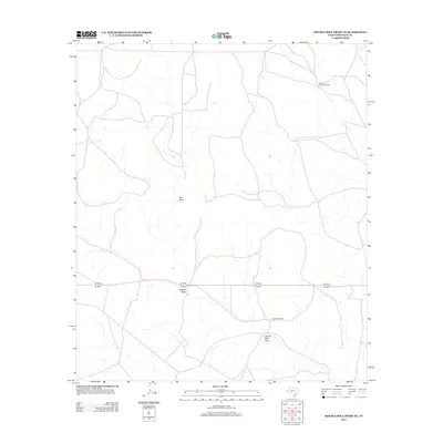
2012 Map of Double Mill Draw NE
USGS Topo · Published 2012About this map
Double Mill Draw defines the arid drainage patterns of this Crockett County landscape, where ephemeral watercourses like Salt Draw and Puckett Draw slice through the terrain. The map reflects a classic West Texas ranching economy, centered around established family holdings and the vital infrastructure of water management. Notable landmarks include the Buckhorn Ranch and Oglesby Ranch, illustrating the sparse but persistent settlement pattern of the region. The inclusion of the Devils River Windmill highlights the critical role of groundwater extraction in sustaining life and livestock in this environment, where named windmills often serve as essential navigational and historical markers for local landowners and genealogists tracking rural property lines.
Find a feature on this map
6 named features on this map. Tap any name to fly to it.
Don’t see what you’re looking for? This feature index may not catch every label — zoom into the map to look around manually.
Map Details
Editions of this 2012 Double Mill Draw NE Map
This is the sole edition of this map. No revisions or reprints were ever made.
Other maps of this area

1895 · Sherwood
USGS Topo · 1:125,000

1920 · Barnhart
USGS Topo · 1:62,500

1922 · Barnhart
USGS Topo · 1:62,500

1954 · Sonora
USGS Topo · 1:250,000

1954 · San Angelo
USGS Topo · 1:250,000

1958 · Sonora
USGS Topo · 1:250,000

1958 · San Angelo
USGS Topo · 1:250,000

1964 · Oglesby Ranch
USGS Topo · 1:24,000

1964 · Bailey Draw
USGS Topo · 1:24,000

1965 · San Angelo
USGS Topo · 1:250,000