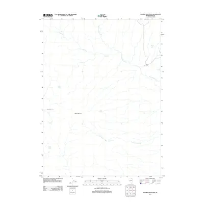
2012 Map of Double Mountain
USGS Topo · Published 2012About this map
Double Mountain and the adjacent Bone Mountains anchor this high-desert landscape in Elko County, where the scarcity of water is reflected in the numerous named springs scattered across the terrain. Vital water sources like Wagon Box Spring, Chicken Creek Springs, and Skull Spring historically served as critical waypoints in this arid environment. The map shows a network of drainage systems including Jakes Creek and the West Fork Beaver Creek, which carve through the high elevations. Apart from the isolated Brown House located near the eastern edge, the area remains largely defined by its natural topography rather than human settlement. The placement of features such as Rodeo Spring and Double Mountain Spring suggests a history of livestock grazing and land use dependent on these ephemeral water points. This topographic study captures the fundamental relationship between the high-basin terrain and the life-sustaining springs that define its character.
Find a feature on this map
14 named features on this map. Tap any name to fly to it.
Don’t see what you’re looking for? This feature index may not catch every label — zoom into the map to look around manually.
Map Details
Editions of this 2012 Double Mountain Map
This is the sole edition of this map. No revisions or reprints were ever made.
Other maps of this area

1935 · Charleston
USGS Topo · 1:48,000

1942 · Mt. Velma
USGS Topo · 1:62,500

1955 · Wells
USGS Topo · 1:250,000

1956 · Wild Horse
USGS Topo · 1:62,500

1958 · Wells
USGS Topo · 1:250,000

1961 · Wells
USGS Topo · 1:250,000

1971 · Double Mtn
USGS Topo · 1:24,000

1971 · Devils Armchair
USGS Topo · 1:24,000

1971 · North Fork
USGS Topo · 1:24,000

1971 · Double Mtn SE
USGS Topo · 1:24,000