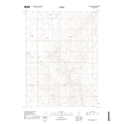
2018 Map of Double Mountain SE
USGS Topo · Published 2018About this map
Coupling Field and Bassit Field occupy the northern reaches of this Elko County landscape, where the high desert terrain transitions into the rugged elevations of the Adobe Range and the Mallard Hills. The hydrological network is dominated by the N Fork Humboldt River, which draws from numerous tributaries including Beaver Cr, Horse Cr, and Cottonwood Cr. This area is characterized by the distinct physical separation of drainage basins, seen in the transition from Willming Valley to Bone Valley. The presence of isolated water sources like Warm Springs and Willow Spring highlights the critical importance of reliable water in this arid Nevada environment, serving as vital landmarks for navigation and land use throughout the region's ranching and migratory history.
Find a feature on this map
19 named features on this map. Tap any name to fly to it.
Don’t see what you’re looking for? This feature index may not catch every label — zoom into the map to look around manually.
Map Details
Editions of this 2018 Double Mountain SE Map
This is the sole edition of this map. No revisions or reprints were ever made.
Other maps of this area

1955 · Wells
USGS Topo · 1:250,000

1958 · Wells
USGS Topo · 1:250,000

1961 · Wells
USGS Topo · 1:250,000

1967 · Hanks Creek SW
USGS Topo · 1:24,000

1967 · Stag Mountain
USGS Topo · 1:24,000

1967 · Peko Peak
USGS Topo · 1:24,000

1971 · Double Mtn
USGS Topo · 1:24,000

1971 · Devils Armchair
USGS Topo · 1:24,000
1971 · Coal Mine Basin
USGS Topo · 1:24,000

1971 · Double Mtn SE
USGS Topo · 1:24,000