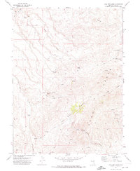
1971 Map of Coal Mine Basin
USGS Topo · Published 1974About this map
Mining and ranching infrastructure define this high-altitude corner of Elko County, where the Adobe Range meets the Coal Mine Basin. Surveyed in the late 1960s and field-checked in 1971, the map reveals a network of primitive access routes like the Coal Mine Road and numerous Jeep Trails connecting remote water sources and extraction points. The topography is characterized by deep drainage systems such as Coal Mine Canyon and Long Canyon, which channel seasonal water toward the lower basins.
Find a feature on this map
25 named features on this map. Tap any name to fly to it.
Don’t see what you’re looking for? This feature index may not catch every label — zoom into the map to look around manually.
Map Details
Editions of this 1971 Coal Mine Basin Map
2 editions found
Other maps of this area

1955 · Wells
USGS Topo · 1:250,000

1958 · Wells
USGS Topo · 1:250,000

1961 · Wells
USGS Topo · 1:250,000
1971 · Dinner Station
USGS Topo · 1:24,000
1971 · The Buttes
USGS Topo · 1:24,000
1971 · Wieland Flat
USGS Topo · 1:24,000

1971 · Double Mtn SE
USGS Topo · 1:24,000
1971 · Coal Mine Canyon SE
USGS Topo · 1:24,000
1971 · Mahala Creek East
USGS Topo · 1:24,000
1972 · The Narrows
USGS Topo · 1:24,000