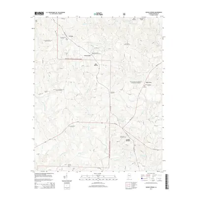
2014 Map of Double Springs
USGS Topo · Published 2014About this map
William B. Bankhead National Forest covers large sections of this Winston County landscape, where the town of Double Springs serves as a central hub. The area is defined by a dense network of watercourses, including Clear Creek and Cane Creek, which carve through the terrain near landmarks like Devils Backbone and Sweetwater Canyon. The map reveals a deeply rooted rural community, evidenced by the high density of combination church and cemetery sites that anchor small settlements like Ashridge, Pleasant Hill, and Rock Creek.
Find a feature on this map
77 named features on this map. Tap any name to fly to it.
Don’t see what you’re looking for? This feature index may not catch every label — zoom into the map to look around manually.
Map Details
Editions of this 2014 Double Springs Map
This is the sole edition of this map. No revisions or reprints were ever made.
Other maps of this area

1936 · Delmar
USGS Topo · 1:24,000

1936 · Kinlock Spring
USGS Topo · 1:24,000

1936 · Moulton
USGS Topo · 1:48,000

1940 · Mt Hope
USGS Topo · 1:62,500

1947 · Kinlock Spring
USGS Topo · 1:24,000
1949 · Kinlock Spring
USGS Topo · 1:24,000

1956 · Gadsden
USGS Topo · 1:250,000

1958 · Gadsden
USGS Topo · 1:250,000
1958 · Haleyville East
USGS Topo · 1:24,000
1958 · Lynn
USGS Topo · 1:24,000