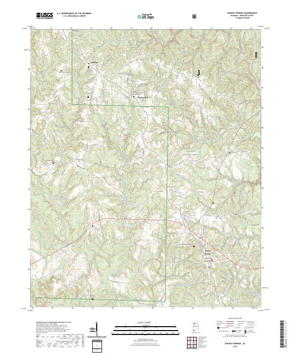
2024 Map of Double Springs
USGS Topo · Published 2024About this map
Double Springs serves as the focal point of this North Alabama landscape, situated within the bounds of the William B. Bankhead National Forest. This modern record of Winston County illustrates a settlement pattern deeply rooted in rural community life, where the Winston County Courthouse anchors the county seat while numerous outlying churches and cemeteries, such as the Pleasant Hill Number Two Missionary Baptist Church Cem, remain vital landmarks.
Find a feature on this map
121 named features on this map. Tap any name to fly to it.
Don’t see what you’re looking for? This feature index may not catch every label — zoom into the map to look around manually.
Map Details
Editions of this 2024 Double Springs Map
This is the sole edition of this map. No revisions or reprints were ever made.
Other maps of this area

1936 · Delmar
USGS Topo · 1:24,000

1936 · Kinlock Spring
USGS Topo · 1:24,000

1936 · Moulton
USGS Topo · 1:48,000

1940 · Mt Hope
USGS Topo · 1:62,500

1947 · Kinlock Spring
USGS Topo · 1:24,000
1949 · Kinlock Spring
USGS Topo · 1:24,000

1956 · Gadsden
USGS Topo · 1:250,000

1958 · Gadsden
USGS Topo · 1:250,000
1958 · Haleyville East
USGS Topo · 1:24,000
1958 · Lynn
USGS Topo · 1:24,000