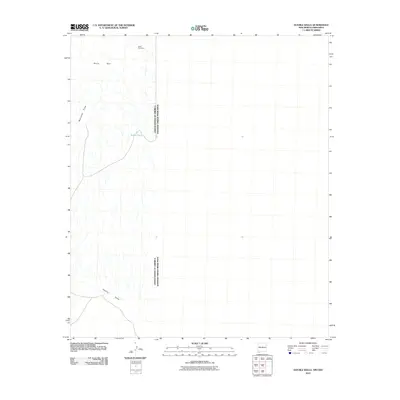
2010 Map of Double Wells
USGS Topo · Published 2010About this map
The United States of America and Estados Unidos Mexicanos border bisects this arid stretch of the Chihuahuan desert landscape. The terrain is defined by the prominent heights of the Sierra Rica, which overlook the expansive Hachita Valley to the south. In the northern reaches, the presence of the Silver Fox Mine points to the regional history of mineral exploration. Water is a scarce and vital resource in this environment, evidenced by labels for ephemeral drainage systems like Muscratch Draw and the human-engineered Border Tank. This survey provides a precise layout of the international boundary and the topographic features that dictated movement and settlement across this binational corridor during the early twenty-first century.
Find a feature on this map
6 named features on this map. Tap any name to fly to it.
Don’t see what you’re looking for? This feature index may not catch every label — zoom into the map to look around manually.
Map Details
Editions of this 2010 Double Wells Map
This is the sole edition of this map. No revisions or reprints were ever made.
Other maps of this area

1918 · Big Hatchet Peak
USGS Topo · 1:62,500

1918 · Hachita
USGS Topo · 1:62,500

1918 · Victorio
USGS Topo · 1:62,500

1955 · Douglas
USGS Topo · 1:250,000

1959 · Douglas
USGS Topo · 1:250,000

1961 · Douglas
USGS Topo · 1:250,000

1964 · Douglas
USGS Topo · 1:250,000
1964 · Victorio Ranch SE
USGS Topo · 1:24,000
1965 · Victorio Ranch
USGS Topo · 1:24,000
1982 · Doyle Peak
USGS Topo · 1:24,000