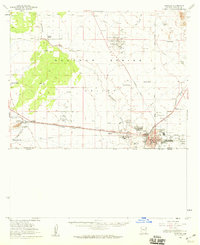
1958 Map of Douglas
USGS Topo · Published 1959About this map
Industrial stacks and cooling facilities of the Copper Queen Smelter dominate the southern edge of this Arizona borderland survey, marking the vital copper industry of the late 1950s. The city of Douglas serves as a major rail and transit hub, where the Southern Pacific railroad parallels the international boundary with Mexico. Northward, the Sulphur Springs Valley opens into a landscape of large-scale cattle operations and isolated homesteads, including Harris Ranch, Watson Ranch, and Double Adobe. Local infrastructure is well-defined, from the Bisbee-Douglas International Airport to the cluster of cemeteries like Sacred Heart Cemetery and Calvary Cem near Pirtleville. This map documents a period of Cold War era aviation and mining growth, featuring the Forrest Airport, several pipelines, and the Arizona Inspection Station at the eastern approach via the Geronimo Trail.
Find a feature on this map
45 named features on this map. Tap any name to fly to it.
Don’t see what you’re looking for? This feature index may not catch every label — zoom into the map to look around manually.
Map Details
Editions of this 1958 Douglas Map
2 editions found
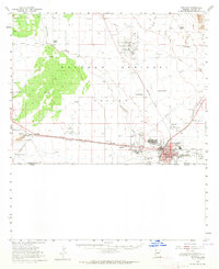
Other maps of this area

1902 · Bisbee
USGS Topo · 1:62,500

1910 · Bisbee
USGS Topo · 1:62,500

1914 · Douglas
USGS Topo · 1:62,500

1916 · Pearce
USGS Topo · 1:125,000

1916 · Douglas
USGS Topo · 1:125,000

1917 · Chiricahua
USGS Topo · 1:125,000

1919 · Douglas
USGS Topo · 1:125,000

1919 · Perilla
USGS Topo · 1:125,000

1919 · Chiricahua
USGS Topo · 1:125,000

1922 · Swisshelm
USGS Topo · 1:62,500