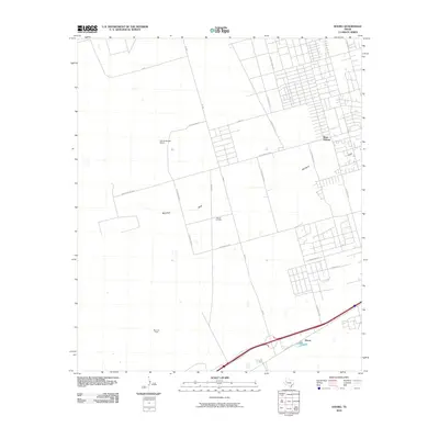
2010 Map of Douro
USGS Topo · Published 2010About this map
West Odessa expands across the northeastern corner of this West Texas landscape, showing a grid of residential streets like N Mark Twain Ave and N Oakhill Ave that meet the open ranching and oil lands to the west. The terrain is defined by the subtle depression of Monahan Draw, which snakes across the center of the sheet near Old Buchanan Ranch. This map captures the industrial character of Ector County during the early 21st century, with the Harper Oil Field and Moss Oil Field marking the significant petroleum infrastructure that drives the local economy. To the south, the settlement of Douro sits along the transportation corridor of W Murphy St, where the desert scrub gives way to the infrastructure of the Permian Basin.
Find a feature on this map
22 named features on this map. Tap any name to fly to it.
Don’t see what you’re looking for? This feature index may not catch every label — zoom into the map to look around manually.
Map Details
Editions of this 2010 Douro Map
This is the sole edition of this map. No revisions or reprints were ever made.
Other maps of this area

1954 · Pecos
USGS Topo · 1:250,000

1957 · Pecos
USGS Topo · 1:250,000

1964 · Odessa SW
USGS Topo · 1:24,000

1964 · Odessa NW
USGS Topo · 1:24,000

1964 · Turnbaugh Corner
USGS Topo · 1:24,000

1964 · Douro
USGS Topo · 1:24,000

1964 · Metz
USGS Topo · 1:24,000

1964 · Red Lakes
USGS Topo · 1:24,000

1964 · Penwell
USGS Topo · 1:24,000

1964 · Clark Brothers Ranch
USGS Topo · 1:24,000