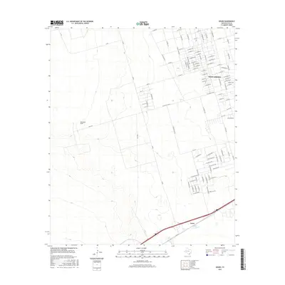
2016 Map of Douro
USGS Topo · Published 2016About this map
West Odessa and its westward expansion define the landscape of the Permian Basin in this mid-2010s survey. The map details an extensive grid of residential streets including W Palomino Dr, W Westridge Dr, and N Eagle Nest Ave as they push into the surrounding plains. The drainage of Monahans Draw cuts across the center of the quadrangle, providing a rare topographical break in the relatively flat terrain. Further south, the settlement of Douro sits along the primary transportation corridor of Interstate 20, serving as a secondary focal point to the residential density in the north. The presence of FM 866 and W Yukon Rd highlights the vital road network supporting the region's industrial and residential connectivity.
Find a feature on this map
98 named features on this map. Tap any name to fly to it.
Don’t see what you’re looking for? This feature index may not catch every label — zoom into the map to look around manually.
Map Details
Editions of this 2016 Douro Map
This is the sole edition of this map. No revisions or reprints were ever made.
Other maps of this area

1954 · Pecos
USGS Topo · 1:250,000

1957 · Pecos
USGS Topo · 1:250,000

1964 · Odessa SW
USGS Topo · 1:24,000

1964 · Odessa NW
USGS Topo · 1:24,000

1964 · Turnbaugh Corner
USGS Topo · 1:24,000

1964 · Douro
USGS Topo · 1:24,000

1964 · Metz
USGS Topo · 1:24,000

1964 · Red Lakes
USGS Topo · 1:24,000

1964 · Penwell
USGS Topo · 1:24,000

1964 · Clark Brothers Ranch
USGS Topo · 1:24,000