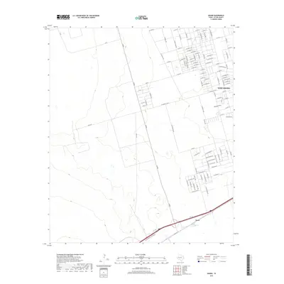
2019 Map of Douro
USGS Topo · Published 2019About this map
West Odessa and the rail-aligned community of Douro anchor this Ector County landscape, where the residential expansion of West Texas meets the open terrain of the Permian Basin. The map shows a clear transition from the densely gridded suburban street network in the northeast—featuring long thoroughfares like W Yukon Rd and W 67th St—to the more sparse, industrial-adjacent lands to the southwest. FM 866 serves as a primary north-south artery, cutting through the center of the sheet and crossing the dry channel of Monahans Draw. This drainage feature provides a rare topographical break in an otherwise flat expanse dominated by oil field access roads and late-20th-century residential development. The infrastructure here reveals the characteristic layout of an area built around both petroleum extraction and the mid-century growth of nearby Odessa.
Find a feature on this map
104 named features on this map. Tap any name to fly to it.
Don’t see what you’re looking for? This feature index may not catch every label — zoom into the map to look around manually.
Map Details
Editions of this 2019 Douro Map
This is the sole edition of this map. No revisions or reprints were ever made.
Other maps of this area

1954 · Pecos
USGS Topo · 1:250,000

1957 · Pecos
USGS Topo · 1:250,000

1964 · Odessa SW
USGS Topo · 1:24,000

1964 · Odessa NW
USGS Topo · 1:24,000

1964 · Turnbaugh Corner
USGS Topo · 1:24,000

1964 · Douro
USGS Topo · 1:24,000

1964 · Metz
USGS Topo · 1:24,000

1964 · Red Lakes
USGS Topo · 1:24,000

1964 · Penwell
USGS Topo · 1:24,000

1964 · Clark Brothers Ranch
USGS Topo · 1:24,000