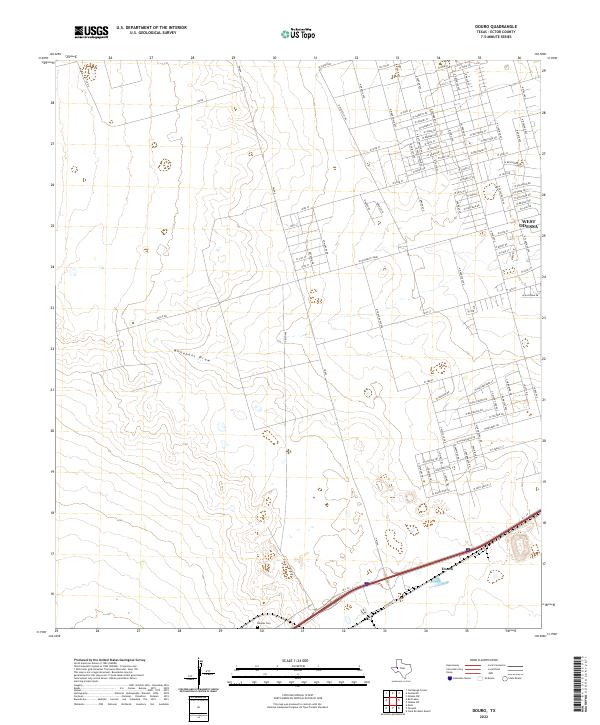
2022 Map of Douro
USGS Topo · Published 2022About this map
The western edges of the Permian Basin's urban core meet the high desert plains in this survey of the West Odessa vicinity. The landscape is defined by the transition from dense residential grids in the northeast to the open, arid terrain of the southwest, where the ephemeral Monahans Draw carves a path through the limestone-and-caliche landscape. In the southern portion of the sheet, the settlement of Douro sits near the crossing of major transit corridors, while the Rhodes Cem provides a specific point of interest for genealogists and local historians tracking early family names in Ector County. The extensive network of secondary roads, such as FM 866 and W Yukon Rd, reflects the industrial and residential expansion characteristic of this oil-rich region of West Texas, showing how modern development has been layered over the older ranching and transit foundations.
Find a feature on this map
108 named features on this map. Tap any name to fly to it.
Don’t see what you’re looking for? This feature index may not catch every label — zoom into the map to look around manually.
Map Details
Editions of this 2022 Douro Map
This is the sole edition of this map. No revisions or reprints were ever made.
Other maps of this area

1954 · Pecos
USGS Topo · 1:250,000

1957 · Pecos
USGS Topo · 1:250,000

1964 · Odessa SW
USGS Topo · 1:24,000

1964 · Odessa NW
USGS Topo · 1:24,000

1964 · Turnbaugh Corner
USGS Topo · 1:24,000

1964 · Douro
USGS Topo · 1:24,000

1964 · Metz
USGS Topo · 1:24,000

1964 · Red Lakes
USGS Topo · 1:24,000

1964 · Penwell
USGS Topo · 1:24,000

1964 · Clark Brothers Ranch
USGS Topo · 1:24,000