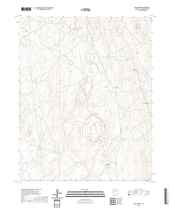
2021 Map of Dove Spring
USGS Topo · Published 2021About this map
Kaibito Plateau dominates this high-elevation landscape in Coconino County, characterized by prominent geological formations and isolated water sources. The map highlights Little Black Mesa in the northeastern quadrant and the distinctive Mormon Ridges to its south. Vital to this arid region is Dove Spring, located near the center of the survey. Transportation through this part of the Navajo Nation is facilitated by Indian Rte 20 and Indian Rte 6210, which navigate around landmark features such as Hole in Rock. The survey provides an exacting record of the township and range lines across T37N R8E and T36N R9E, reflecting the modern administrative and topographic state of the Arizona high desert.
Find a feature on this map
11 named features on this map. Tap any name to fly to it.
Don’t see what you’re looking for? This feature index may not catch every label — zoom into the map to look around manually.
Map Details
Editions of this 2021 Dove Spring Map
This is the sole edition of this map. No revisions or reprints were ever made.
Other maps of this area

1886 · Echo Cliffs
USGS Topo · 1:250,000

1891 · Echo Cliffs
USGS Topo · 1:250,000

1954 · Shinumo Altar NE
USGS Topo · 1:24,000

1954 · Tanner Wash
USGS Topo · 1:62,500

1954 · Shinumo Altar
USGS Topo · 1:62,500

1955 · Tanner Wash NE
USGS Topo · 1:24,000

1956 · Marble Canyon
USGS Topo · 1:250,000

1959 · Marble Canyon
USGS Topo · 1:250,000

1961 · Marble Canyon
USGS Topo · 1:250,000
1982 · Toh Bih Nosteny
USGS Topo · 1:24,000