
1935 Map of Dover-Foxcroft
USGS Topo · Published 1935About this map
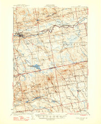
The Piscataquis River cuts through the heart of this central Maine landscape, anchoring the bustling industrial hub of Dover-Foxcroft. In the mid-1930s, the region was defined by a dense network of rural schoolhouses and family-named corners, reflecting a settled agricultural and timber economy. One can trace the Maine Central railroad corridor as it passes East Dover and Sebec Sta Po, while smaller hamlets like Silvers Mills and Dover South Mills illustrate the local importance of water power at sites like Branns Mill Pond.
Find a feature on this map
93 named features on this map. Tap any name to fly to it.
Don’t see what you’re looking for? This feature index may not catch every label — zoom into the map to look around manually.
Map Details
Editions of this 1935 Dover-Foxcroft Map
2 editions found
Other maps of this area

1902 · Bangor
USGS Topo · 1:62,500

1930 · Pittsfield
USGS Topo · 1:48,000

1931 · Stetson
USGS Topo · 1:48,000

1932 · Dover-Foxcroft
USGS Topo · 1:48,000

1932 · Pittsfield
USGS Topo · 1:62,500

1933 · Boyd Lake
USGS Topo · 1:62,500

1933 · Pittsfield
USGS Topo · 1:62,500

1933 · Guilford
USGS Topo · 1:62,500

1935 · Stetson
USGS Topo · 1:62,500

1937 · Guilford
USGS Topo · 1:62,500