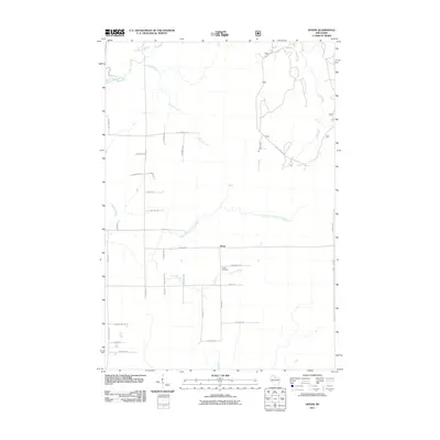
2011 Map of Dover
USGS Topo · Published 2011About this map
Emery Cemetery and the small settlement of Dover serve as the primary landmarks in this rural Price County landscape during the early 21st century. The terrain is defined by an intricate network of waterways, most notably the Elk River and its various tributaries including Horton Creek and Musser Creek. The southern portion of the area is particularly water-rich, where the North Branch Little Elk River and the Little Elk River meander through the countryside. The road system is a mix of designated forest routes and local drives named for regional flora and family homesteads, such as Forest Rd 503 and Emery Hackett Rd. This survey captures a moment when the transition between managed forest lands and small agricultural plots remained a central characteristic of the region, anchored by the throughfare of County Hwy H.
Find a feature on this map
40 named features on this map. Tap any name to fly to it.
Don’t see what you’re looking for? This feature index may not catch every label — zoom into the map to look around manually.
Map Details
Editions of this 2011 Dover Map
This is the sole edition of this map. No revisions or reprints were ever made.
Other maps of this area

1941 · Park Falls
USGS Topo · 1:48,000

1941 · Pike Lake
USGS Topo · 1:48,000

1941 · Phillips
USGS Topo · 1:48,000

1941 · Brantwood
USGS Topo · 1:48,000

1942 · Pike Lake
USGS Topo · 1:48,000

1943 · Park Falls
USGS Topo · 1:48,000

1943 · Philliips
USGS Topo · 1:48,000

1943 · Brantwood
USGS Topo · 1:48,000

1947 · Park Falls
USGS Topo · 1:48,000

1950 · Pike Lake
USGS Topo · 1:48,000