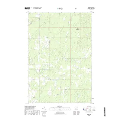
2018 Map of Dover
USGS Topo · Published 2018About this map
Chequamegon National Forest encompasses the northern portion of this Price County landscape, where the headwaters of the Elk River and its various branches create a complex system of wetlands and small waterways. The settlement of Dover sits centrally along Co Rd D, serving as a local hub in an area defined by forestry and rural homesteads. This 2018 survey reveals a network of roads named for local families and natural features, such as Martins Dr, Hornick Rd, and Blueberry Dr, which provide access to the dense woodland interior. Genealogists may find particular value in the location of the Emery Cem, situated just east of the main settlement near the Little Elk River. The map highlights the modern intersection of conservation land and private property, showing how the drainage of N-Br Little Elk River and Horton Cr dictates the local geography.
Find a feature on this map
35 named features on this map. Tap any name to fly to it.
Don’t see what you’re looking for? This feature index may not catch every label — zoom into the map to look around manually.
Map Details
Editions of this 2018 Dover Map
This is the sole edition of this map. No revisions or reprints were ever made.
Other maps of this area

1941 · Park Falls
USGS Topo · 1:48,000

1941 · Pike Lake
USGS Topo · 1:48,000

1941 · Phillips
USGS Topo · 1:48,000

1941 · Brantwood
USGS Topo · 1:48,000

1942 · Pike Lake
USGS Topo · 1:48,000

1943 · Park Falls
USGS Topo · 1:48,000

1943 · Philliips
USGS Topo · 1:48,000

1943 · Brantwood
USGS Topo · 1:48,000

1947 · Park Falls
USGS Topo · 1:48,000

1950 · Pike Lake
USGS Topo · 1:48,000