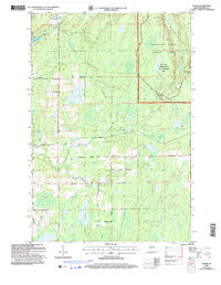
2005 Map of Dover
USGS Topo · Published 2006About this map
The town of Dover anchors this rural landscape in Price County, where the intersection of Dover Road and Birchwood Drive marks the local civic center, including the Townhall and the nearby Emery Cem. The terrain is defined by the winding waters of the Little Elk River and the Elk River, which flow through the forested township boundaries of Worcester, Emery, and Hackett. A significant portion of the northeast is dedicated to the Elk Valley Semi-Primitive Non Motorized Area within the Chequamegon-Nicolet National Forest, illustrating a landscape managed for conservation and limited-access recreation. Small settlements like Uher and numerous scattered gravel pits suggest a quiet economy based on timber, local infrastructure, and the maintenance of a sprawling network of forest roads such as Musser Drive and Blueberry Drive.
Find a feature on this map
24 named features on this map. Tap any name to fly to it.
Don’t see what you’re looking for? This feature index may not catch every label — zoom into the map to look around manually.
Map Details
Editions of this 2005 Dover Map
This is the sole edition of this map. No revisions or reprints were ever made.
Other maps of this area

1941 · Park Falls
USGS Topo · 1:48,000

1941 · Pike Lake
USGS Topo · 1:48,000

1941 · Phillips
USGS Topo · 1:48,000

1941 · Brantwood
USGS Topo · 1:48,000

1942 · Pike Lake
USGS Topo · 1:48,000

1943 · Park Falls
USGS Topo · 1:48,000

1943 · Philliips
USGS Topo · 1:48,000

1943 · Brantwood
USGS Topo · 1:48,000

1947 · Park Falls
USGS Topo · 1:48,000

1950 · Pike Lake
USGS Topo · 1:48,000