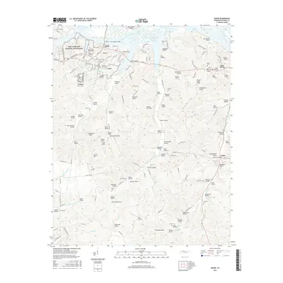
2016 Map of Dover
USGS Topo · Published 2016About this map
Fort Donelson National Battlefield anchors the northwestern corner of this landscape, preserving the site of a pivotal Civil War conflict along the banks of Lake Barkley. This 2016 survey captures the area around Dover, the county seat of Stewart County, showing a geography defined by the impounded waters of the Cumberland River. The terrain is deeply dissected by countless hollows, such as Rattlesnake Hollow and Dunaway Hollow, which drain toward the larger valleys of Lick Creek and Long Creek. Genealogists will find a high density of rural burial sites, including the Fort Donelson National Cemetery, Bear Spring Cemetery, and the Settle Cemetery. Moving south toward Tennessee Ridge, the map illustrates how modern infrastructure like the Sidney C Lewis Highway Bridge and Donelson Parkway interacts with the older, intricate network of ridge roads and valley settlements like Carlisle.
Find a feature on this map
160 named features on this map. Tap any name to fly to it.
Don’t see what you’re looking for? This feature index may not catch every label — zoom into the map to look around manually.
Map Details
Editions of this 2016 Dover Map
This is the sole edition of this map. No revisions or reprints were ever made.
Other maps of this area

1931 · Erin
USGS Topo · 1:62,500

1936 · Tharpe
USGS Topo · 1:24,000

1936 · Tantrough Hollow
USGS Topo · 1:24,000

1936 · McKinnon
USGS Topo · 1:24,000

1936 · Stewart
USGS Topo · 1:24,000

1936 · Standing Rock
USGS Topo · 1:24,000

1936 · Dover
USGS Topo · 1:24,000

1950 · Stewart
USGS Topo · 1:24,000

1950 · Standing Rock
USGS Topo · 1:24,000

1950 · Dover
USGS Topo · 1:24,000