2023 Map of Dover
USGS Topo · Published 2023About this map
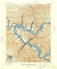
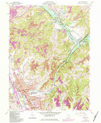
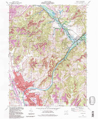
The Tuscarawas River carves a significant corridor through this region of Ohio, shaping the development of Dover and the northern reaches of New Philadelphia. The landscape is defined by the river's broad valley and several tributary runs, including Wolf Run and Goettge Run, which cut through the surrounding uplands. Local history is deeply embedded in the numerous burial sites across the township lines, ranging from the central Maple Grove Cem and Saint Josephs Cem in the urban core to the more secluded Bisel Church Cem and Ruslin Hill Cem in the rural outskirts. Modern transport and industrial patterns are reflected in the route of the R J Corman RR, which follows the river's natural grade. The northern portion of the map highlights the distinct planned character of Wilkshire Hills and the historic vicinity of Zoar, where Zoar Lake and Zoar Cem mark the legacy of early communal settlement.
Find a feature on this map
111 named features on this map. Tap any name to fly to it.
Don’t see what you’re looking for? This feature index may not catch every label — zoom into the map to look around manually.
Map Details
Editions of this 2023 Dover Map
This is the sole edition of this map. No revisions or reprints were ever made.
Historical Maps of Zoarville Through Time
5 maps found