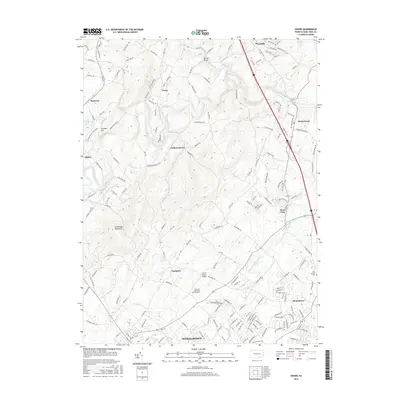
2016 Map of Dover
USGS Topo · Published 2016About this map
Conewago Creek and the Little Conewago Creek anchor the landscape of northern York County, carving through a region defined by scattered residential growth and deep-rooted rural crossings. The northern reach is distinguished by the Kise Mill Bridge spanning Bennett Run, while the southern portion of the map transitions into the denser suburban developments of Weigelstown and Roundtown. This modern topographic perspective documents the road networks connecting historic community centers like Strinestown, Zions View, and Andersontown. Notable landmarks including the Lazy B Ranch Airport and large memorial sites like Suburban Memorial Gardens illustrate the evolving use of the land between the high ground of Conewago Mountain and the water-carved valleys of Fox Run and Stony Run.
Find a feature on this map
172 named features on this map. Tap any name to fly to it.
Don’t see what you’re looking for? This feature index may not catch every label — zoom into the map to look around manually.
Map Details
Editions of this 2016 Dover Map
This is the sole edition of this map. No revisions or reprints were ever made.
Other maps of this area

1906 · New Cumberland
USGS Topo · 1:62,500

1908 · Middletown
USGS Topo · 1:62,500

1908 · York
USGS Topo · 1:62,500

1910 · York
USGS Topo · 1:62,500

1920 · Hanover
USGS Topo · 1:62,500

1922 · Hanover
USGS Topo · 1:62,500

1943 · New Cumberland
USGS Topo · 1:62,500

1943 · Middletown
USGS Topo · 1:62,500

1948 · Baltimore
USGS Topo · 1:250,000

1950 · Harrisburg
USGS Topo · 1:250,000
Featured Places
- Manchester Township, PA
- East Manchester Township, PA
- Warrington Township, PA
- Zions View, Conewago Township
- Woodside, Newberry Township