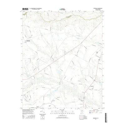
2017 Map of Dovesville
USGS Topo · Published 2017About this map
Birdstown Crossroads and the outskirts of Auburn define the rural character of this Darlington County landscape. The terrain is a complex network of wetlands and drainage basins, notably around Cypress Flat and the meandering path of Black Cr. These water features historically supported local industry and agriculture, evidenced by Mcintosh Millpond and Jeffords Millpond. The map captures a moment when traditional land use, represented by numerous family and community burial grounds such as Howle Cem and Centerville Cem, exists alongside modern infrastructure like the Darlington County Airport. Transportation is anchored by the Dovesville Hwy and several established rural routes including E Old Camden Rd, while the northern boundary is marked by the line between Chesterfield Co and Darlington Co.
Find a feature on this map
88 named features on this map. Tap any name to fly to it.
Don’t see what you’re looking for? This feature index may not catch every label — zoom into the map to look around manually.
Map Details
Editions of this 2017 Dovesville Map
This is the sole edition of this map. No revisions or reprints were ever made.
Other maps of this area

1941 · Spartanburg
USGS Topo · 1:250,000

1942 · Rockingham
USGS Topo · 1:125,000

1953 · Florence
USGS Topo · 1:250,000

1953 · Spartanburg
USGS Topo · 1:250,000

1954 · Florence
USGS Topo · 1:250,000

1960 · Spartanburg
USGS Topo · 1:250,000

1963 · Spartanburg
USGS Topo · 1:250,000

1963 · Dovesville
USGS Topo · 1:24,000

1963 · Mont Clare
USGS Topo · 1:24,000

1963 · Darlington East
USGS Topo · 1:24,000