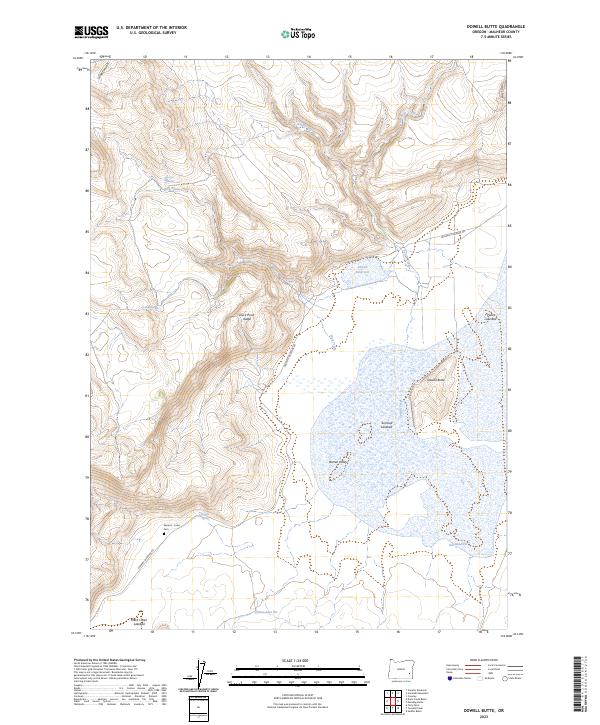
2023 Map of Dowell Butte
USGS Topo · Published 2023About this map
Seward - Curks Cem serves as a singular point of interest in this high desert landscape, located along the Crowley-Riverside Rd in Malheur County. The terrain is characterized by a series of ephemeral water systems and significant topographic shifts, including the rise of Dowell Butte and the long expanse of Duck Pond Ridge. The mapping of several dry basins, such as Piute Lake Bed, Turnbull Lakebed, and Duck Creek Lakebed, reflects the seasonal hydrology of Barren Valley. This area is marked by its isolation and specialized land use, where vital water sources like Scottys Springs, Cold Spring, and Skylight Spring are essential landmarks. Evidence of local extractive industry is visible at Obenchain Pit and Diamond Pit, while the branching drainage of Soldier Creek, Stockade Creek, and Sutton Creek defines the northern reaches of the quadrangle.
Find a feature on this map
25 named features on this map. Tap any name to fly to it.
Don’t see what you’re looking for? This feature index may not catch every label — zoom into the map to look around manually.
Map Details
Editions of this 2023 Dowell Butte Map
This is the sole edition of this map. No revisions or reprints were ever made.
Other maps of this area

1955 · Burns
USGS Topo · 1:250,000

1955 · Boise
USGS Topo · 1:250,000

1958 · Burns
USGS Topo · 1:250,000

1958 · Boise
USGS Topo · 1:250,000

1959 · Burns
USGS Topo · 1:250,000

1962 · Boise
USGS Topo · 1:250,000
1972 · Saddle Butte
USGS Topo · 1:24,000

1972 · Crowley
USGS Topo · 1:24,000
1972 · Mustang Butte
USGS Topo · 1:24,000
1972 · Stockade Mtn
USGS Topo · 1:62,500