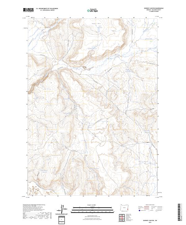
2023 Map of Downey Canyon
USGS Topo · Published 2023About this map
Table Mtn and the high plateaus of Malheur County define this landscape, where water management is the primary driver of development. The area is marked by a series of high-altitude catchments, including Tableland Reservoir, Goodyear Reservoir, and the Downey Cr Reservoir, which capture seasonal flows from drainages like Cow Creek and Mahogany Creek. These water features, alongside various springs such as Oliver Spring and Felt Spring, suggest a region heavily utilized for livestock and ranching rather than dense permanent settlement.
Find a feature on this map
33 named features on this map. Tap any name to fly to it.
Don’t see what you’re looking for? This feature index may not catch every label — zoom into the map to look around manually.
Map Details
Editions of this 2023 Downey Canyon Map
This is the sole edition of this map. No revisions or reprints were ever made.
Other maps of this area

1955 · Jordan Valley
USGS Topo · 1:250,000

1955 · Boise
USGS Topo · 1:250,000

1957 · Jordan Valley
USGS Topo · 1:250,000

1958 · Boise
USGS Topo · 1:250,000

1958 · Jordan Valley
USGS Topo · 1:250,000

1962 · Boise
USGS Topo · 1:250,000
1969 · Mahogany Gap
USGS Topo · 1:24,000

1969 · Mc Cain Creek
USGS Topo · 1:24,000
1969 · Hooker Creek
USGS Topo · 1:24,000

1969 · Cow Lakes
USGS Topo · 1:24,000