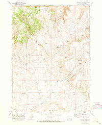
1969 Map of Mahogany Gap
USGS Topo · Published 1973About this map
Mahogany Mountain dominates this high-altitude landscape in Malheur County, where water sources dictate the movement of people and livestock across the high desert. By the late 1960s, a network of Jeep Trails provided the primary access to remote points like Mahogany Gap and Hawks Nest Reservoir. The area is defined by its numerous watering holes, including the curiously named Old Maids Spring, Old Maids Basin Springs, and Gap Spring, which feed into seasonal drainages such as South Fork Carter Creek and Mahogany Creek. This survey illustrates a rugged ranching and grazing environment where named landforms like Spring Mountain and Table Mountain served as vital navigation points. The presence of these named springs suggests the historical importance of localized water rights in this arid stretch of southeastern Oregon.
Find a feature on this map
18 named features on this map. Tap any name to fly to it.
Don’t see what you’re looking for? This feature index may not catch every label — zoom into the map to look around manually.
Map Details
Editions of this 1969 Mahogany Gap Map
This is the sole edition of this map. No revisions or reprints were ever made.
Other maps of this area

1955 · Boise
USGS Topo · 1:250,000

1958 · Boise
USGS Topo · 1:250,000

1962 · Boise
USGS Topo · 1:250,000

1967 · Rockville
USGS Topo · 1:24,000
1967 · Bannock Ridge
USGS Topo · 1:24,000

1967 · Rooster Comb
USGS Topo · 1:24,000

1969 · Mc Cain Creek
USGS Topo · 1:24,000
1969 · Hooker Creek
USGS Topo · 1:24,000

1969 · Cow Lakes
USGS Topo · 1:24,000

1969 · Sheaville
USGS Topo · 1:24,000