
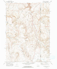
1969 Map of Sheaville
USGS Topo · Published 1973About this map
Sheaville and the surrounding high desert of the Oregon-Idaho borderlands are documented here just as the late 1960s drew to a close. The landscape is defined by its water sources, with names like Sticky Joe Spring, Fenwick Spring, and Shorthorn Spring indicating the vital importance of springs for livestock and survival in this arid terrain. The map records the historical footprint of Camp Lyons (Site) near the confluence of Cow Creek and Succor Creek, a notable location for those tracing early military or pioneer movements through the region. Industrial and ranching activities are evident in the presence of a Coal Mine within the Coal Mine Basin and the established Malloy Ranch. The terrain is marked by significant elevations like Spring Mountain and Thomas Creek Ridge, navigated by a network of unimproved jeep trails that connect remote outposts and resource sites.
Find a feature on this map
45 named features on this map. Tap any name to fly to it.
Don’t see what you’re looking for? This feature index may not catch every label — zoom into the map to look around manually.
Map Details
Editions of this 1969 Sheaville Map
2 editions found
Other maps of this area

1892 · Silver City
USGS Topo · 1:125,000

1894 · Silver City
USGS Topo · 1:125,000

1898 · Silver City
USGS Topo · 1:125,000

1955 · Boise
USGS Topo · 1:250,000

1957 · Sands Basin
USGS Topo · 1:62,500

1958 · Boise
USGS Topo · 1:250,000

1962 · Boise
USGS Topo · 1:250,000

1965 · Rooster Comb Peak
USGS Topo · 1:62,500

1967 · Rockville
USGS Topo · 1:24,000
1967 · Bannock Ridge
USGS Topo · 1:24,000