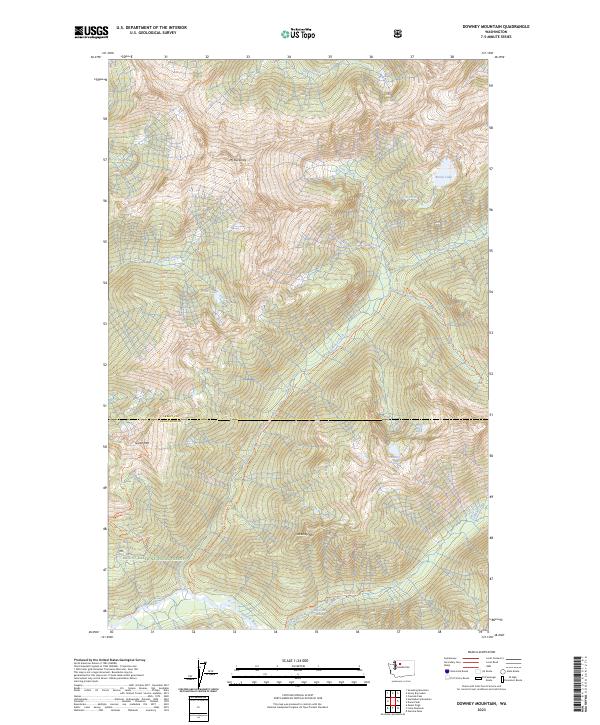
2023 Map of Downey Mountain
USGS Topo · Published 2023About this map
Sulphur Hot Spring and the Suiattle River define the southern drainage of this remote mountain landscape along the border of Skagit and Snohomish counties. Located within the Glacier Peak Wilderness and Mount Baker National Forest, the area is characterized by high alpine peaks like Mt Buckindy, Green Mtn, and Downey Mtn. The map documents a network of backcountry routes, including the Downey Creek Trl and Bachelor Creek Trl, which follow glacial valley floors to high-elevation water bodies such as Horse Lake, Pilot Lake, and Bench Lake. A portion of the Skagit Wild and Scenic River designation covers the southern waterway, indicating the preserved status of this watershed. The intricate contour lines and scattered creeks like Kindy Creek and Goat Creek reveal a terrain largely untouched by modern road development, focused instead on conservation and wilderness recreation.
Find a feature on this map
29 named features on this map. Tap any name to fly to it.
Don’t see what you’re looking for? This feature index may not catch every label — zoom into the map to look around manually.
Map Details
Editions of this 2023 Downey Mountain Map
This is the sole edition of this map. No revisions or reprints were ever made.
Other maps of this area

1899 · Glacier Peak
USGS Topo · 1:125,000

1901 · Glacier Peak
USGS Topo · 1:125,000

1950 · Glacier Peak
USGS Topo · 1:62,500

1955 · Concrete
USGS Topo · 1:250,000

1958 · Concrete
USGS Topo · 1:250,000

1962 · Concrete
USGS Topo · 1:250,000

1963 · Sonny Boy Lakes
USGS Topo · 1:24,000
1963 · Downey Mtn
USGS Topo · 1:24,000
1963 · Dome Peak
USGS Topo · 1:24,000
1963 · Cascade Pass
USGS Topo · 1:24,000