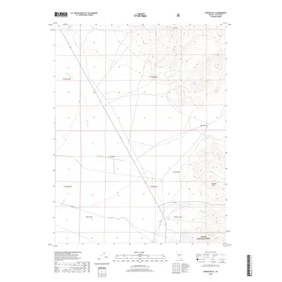
2018 Map of Downeyville
USGS Topo · Published 2018About this map
The high-desert expanse of Gabbs Valley and its surrounding mountain ranges define this part of Nye County. The landscape is structured by the steep elevations of the Paradise Range in the southeast and the Lodi Hills to the north, creating a dramatic basin-and-range topography. Modern transportation and infrastructure are represented by the Gabbs Airport and Del Vega St, providing access points to this sparsely populated region. The Toiyabe National Forest boundary touches the southern edge of the quadrangle, where the terrain rises sharply into McGery Canyon. Hydrological patterns are dominated by the ephemeral Gabbs Wash, which cuts through the valley floor, while Lodi Valley sits as a distinct pocket of level ground between the northern peaks.
Find a feature on this map
14 named features on this map. Tap any name to fly to it.
Don’t see what you’re looking for? This feature index may not catch every label — zoom into the map to look around manually.
Map Details
Editions of this 2018 Downeyville Map
This is the sole edition of this map. No revisions or reprints were ever made.
Other maps of this area

1907 · Tonopah
USGS Topo · 1:250,000

1908 · Tonopah
USGS Topo · 1:250,000

1908 · Carson Sink
USGS Topo · 1:250,000

1909 · Hawthorne
USGS Topo · 1:250,000

1910 · Carson Sink
USGS Topo · 1:250,000

1911 · Hawthorne
USGS Topo · 1:250,000

1915 · Hawthorne
USGS Topo · 1:250,000

1948 · Paradise Peak
USGS Topo · 1:62,500

1948 · Walker Lake
USGS Topo · 1:250,000

1950 · Paradise Peak
USGS Topo · 1:62,500