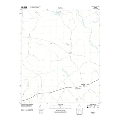
2011 Map of Downs
USGS Topo · Published 2011About this map
Williamson Swamp Creek and Kittrell Creek wind through this rural landscape in central Georgia, defining a territory marked by family-named crossroads and small agricultural hubs. The settlement of Downs serves as a central point, flanked by the smaller locales of Sparks to the northwest and Halls Crossing to the southeast. For those researching local lineages, the map is heavily populated with family burial sites, including the Antioch Cemetery, John Sparks Cemetery, and Halls Cross Roads Cemetery. Water management is evident through several impoundments such as Archers Lakes, Brown Lake, and Jordan Millpond, each with its respective dam. Along the southern edge, the Chickasawhatchie Bridge crosses the marshy terrain near Heidrich Airport, while the Ogeechee River snakes along the eastern boundary, illustrating the complex drainage patterns of the region's low-lying basins.
Find a feature on this map
40 named features on this map. Tap any name to fly to it.
Don’t see what you’re looking for? This feature index may not catch every label — zoom into the map to look around manually.
Map Details
Editions of this 2011 Downs Map
This is the sole edition of this map. No revisions or reprints were ever made.
Other maps of this area

1953 · Athens
USGS Topo · 1:250,000

1957 · Macon
USGS Topo · 1:250,000

1958 · Macon
USGS Topo · 1:250,000

1958 · Athens
USGS Topo · 1:250,000

1959 · Athens
USGS Topo · 1:250,000

1960 · Warthen NE
USGS Topo · 1:24,000

1961 · Warthen
USGS Topo · 1:24,000

1962 · Sandersville
USGS Topo · 1:24,000

1963 · Athens
USGS Topo · 1:250,000

1964 · Macon
USGS Topo · 1:250,000