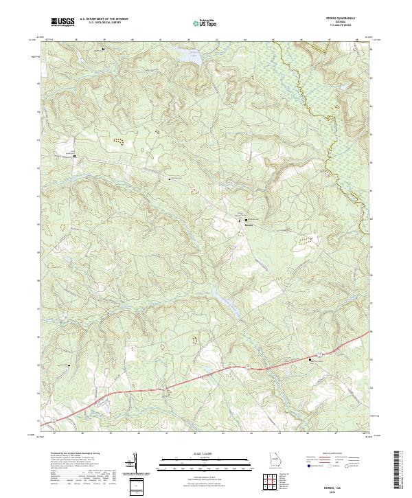
2024 Map of Downs
USGS Topo · Published 2024About this map
Family cemeteries and quiet creek branches define this rural landscape on the border of Washington, Jefferson, and Glascock counties. The small settlement of Downs serves as a central point, anchored by the Downs Baptist Church and its adjacent Downs Baptist Church Cem. The map reveals a land heavily shaped by its waterways, where Williamson Swamp Creek and Kittrell Creek meander through the southern reaches, eventually feeding into the Ogeechee River. The presence of numerous family-named burial sites, such as the John Sparks Cem and Amerson Cem, suggests a long-standing agricultural community where land has been held across generations. In the south, the Fall Line Fwy cuts across the terrain near Halls Cross Roads Cem, marking a modern transportation corridor through this traditional Georgia landscape.
Find a feature on this map
46 named features on this map. Tap any name to fly to it.
Don’t see what you’re looking for? This feature index may not catch every label — zoom into the map to look around manually.
Map Details
Editions of this 2024 Downs Map
This is the sole edition of this map. No revisions or reprints were ever made.
Other maps of this area

1953 · Athens
USGS Topo · 1:250,000

1957 · Macon
USGS Topo · 1:250,000

1958 · Macon
USGS Topo · 1:250,000

1958 · Athens
USGS Topo · 1:250,000

1959 · Athens
USGS Topo · 1:250,000

1960 · Warthen NE
USGS Topo · 1:24,000

1961 · Warthen
USGS Topo · 1:24,000

1962 · Sandersville
USGS Topo · 1:24,000

1963 · Athens
USGS Topo · 1:250,000

1964 · Macon
USGS Topo · 1:250,000