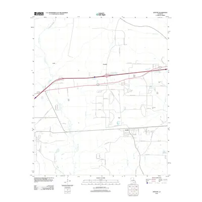
2012 Map of Doyline
USGS Topo · Published 2012About this map
Doyline and the neighboring settlements of Goodwill and Leslie occupy a landscape defined by the winding course of Clarke Bayou and Prairie Bayou. The area's history is preserved through numerous family and community burial grounds, including the Allen Town Cem and Saint James Cem, which serve as vital markers for genealogists researching local heritage. The 2012 survey illustrates a modern transportation network layered over older rural routes, such as Bellevue Oilfield Rd and Syrup Mill Rd, reflecting the region's intersection of traditional agricultural land and the energy industry. Named water bodies like Boone Cr and Caney Br drain the northern reaches of the quadrangle, while a grid of local roads like Bataan Ave and Java Rd provides a detailed look at the residential development and land use patterns near the turn of the 21st century.
Find a feature on this map
69 named features on this map. Tap any name to fly to it.
Don’t see what you’re looking for? This feature index may not catch every label — zoom into the map to look around manually.
Map Details
Editions of this 2012 Doyline Map
This is the sole edition of this map. No revisions or reprints were ever made.
Other maps of this area

1932 · Bossier SE
USGS Topo · 1:31,680

1932 · Bossier NE
USGS Topo · 1:31,680

1938 · Arnsberg
USGS Topo · 1:31,680

1947 · Ringgold
USGS Topo · 1:62,500

1947 · Minden
USGS Topo · 1:62,500

1948 · Bossier City
USGS Topo · 1:62,500

1948 · Caspiana
USGS Topo · 1:62,500

1949 · Minden
USGS Topo · 1:62,500

1955 · Shreveport
USGS Topo · 1:250,000

1955 · Caspiana
USGS Topo · 1:62,500