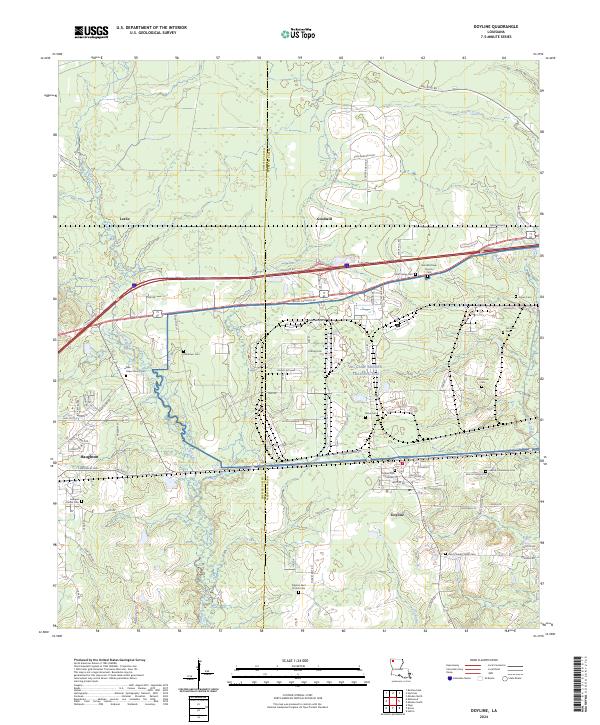
2024 Map of Doyline
USGS Topo · Published 2024About this map
Doyline and Haughton anchor this contemporary survey of the border between Bossier Parish and Webster Parish. The landscape is characterized by a significant military footprint at the NG Camp Minden Training Site, where streets like Bataan Ave and Corregidor reflect a 20th-century history of service. The area remains geographically defined by its low-lying waterways, including the winding Clarke Bayou and Prairie Bayou that traverse the southern reaches of the quadrangle.
Find a feature on this map
78 named features on this map. Tap any name to fly to it.
Don’t see what you’re looking for? This feature index may not catch every label — zoom into the map to look around manually.
Map Details
Editions of this 2024 Doyline Map
This is the sole edition of this map. No revisions or reprints were ever made.
Other maps of this area

1932 · Bossier SE
USGS Topo · 1:31,680

1932 · Bossier NE
USGS Topo · 1:31,680

1938 · Arnsberg
USGS Topo · 1:31,680

1947 · Ringgold
USGS Topo · 1:62,500

1947 · Minden
USGS Topo · 1:62,500

1948 · Bossier City
USGS Topo · 1:62,500

1948 · Caspiana
USGS Topo · 1:62,500

1949 · Minden
USGS Topo · 1:62,500

1955 · Shreveport
USGS Topo · 1:250,000

1955 · Caspiana
USGS Topo · 1:62,500