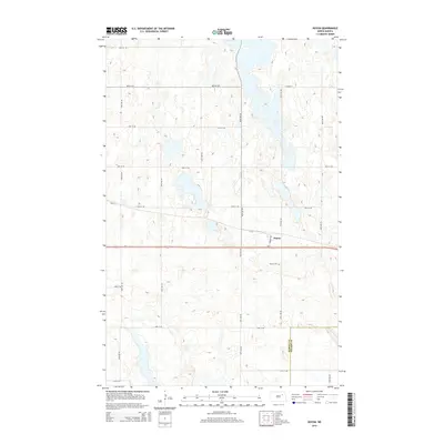
2014 Map of Doyon
USGS Topo · Published 2014About this map
Doyon serves as the focal point of this Eastern North Dakota landscape, situated along the primary corridor of Us-2. The map illustrates a meticulously planned grid of rural roads, including 49th St NE and 96th Ave NE, which organize the surrounding agricultural territory. A significant boundary is noted in the southern portion of the sheet, marking the transition between Ramsey Co and Nelson Co. Local history is anchored by the Doyon Cem, located just south of the main settlement area near Warner Ave. The terrain is characterized by a dense network of seasonal wetlands and small basins typical of the region's prairie pothole geography, influencing the placement of the section-line roads like Co Road 2 and 92nd Ave NE.
Find a feature on this map
23 named features on this map. Tap any name to fly to it.
Don’t see what you’re looking for? This feature index may not catch every label — zoom into the map to look around manually.
Map Details
Editions of this 2014 Doyon Map
This is the sole edition of this map. No revisions or reprints were ever made.
Other maps of this area

1930 · Pekin
USGS Topo · 1:62,500

1930 · Hamar
USGS Topo · 1:62,500

1950 · Devils Lake Mountain
USGS Topo · 1:24,000

1951 · Crary
USGS Topo · 1:24,000

1951 · Devils Lake Mountain
USGS Topo · 1:24,000

1951 · Pekin NW
USGS Topo · 1:24,000

1951 · Free Peoples Lake
USGS Topo · 1:24,000

1951 · Pekin
USGS Topo · 1:62,500

1952 · New Rockford
USGS Topo · 1:250,000

1953 · Devils Lake
USGS Topo · 1:250,000