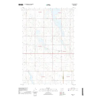
2017 Map of Doyon
USGS Topo · Published 2017About this map
Doyon serves as the central settlement on this North Dakota prairie landscape, situated along the border of Ramsey Co and Nelson Co. This 2017 survey captures the traditional township and range grid system of the Red River Valley region, defined by a dense network of local routes like 49th St NE and 94th Ave NE. The terrain is characterized by an extensive collection of small wetlands and prairie potholes, typical of the glaciated plains, which dictate the winding paths of secondary roads such as Co Hwy 4. For local historians and genealogists, the Doyon Cem located south of the main town site provides a specific point of interest for tracing family roots in this rural agricultural community.
Find a feature on this map
25 named features on this map. Tap any name to fly to it.
Don’t see what you’re looking for? This feature index may not catch every label — zoom into the map to look around manually.
Map Details
Editions of this 2017 Doyon Map
This is the sole edition of this map. No revisions or reprints were ever made.
Other maps of this area

1930 · Pekin
USGS Topo · 1:62,500

1930 · Hamar
USGS Topo · 1:62,500

1950 · Devils Lake Mountain
USGS Topo · 1:24,000

1951 · Crary
USGS Topo · 1:24,000

1951 · Devils Lake Mountain
USGS Topo · 1:24,000

1951 · Pekin NW
USGS Topo · 1:24,000

1951 · Free Peoples Lake
USGS Topo · 1:24,000

1951 · Pekin
USGS Topo · 1:62,500

1952 · New Rockford
USGS Topo · 1:250,000

1953 · Devils Lake
USGS Topo · 1:250,000