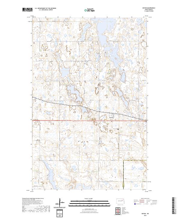
2024 Map of Doyon
USGS Topo · Published 2024About this map
Doyon serves as the primary settlement center for this rural North Dakota landscape, situated along a central transit corridor defined by Warner Ave and the regional highway network. The area's topography is heavily defined by its role in prairie conservation, dominated by multiple segments of the Ramsey County Waterfowl Production Area and several smaller Rc Wpa units. These protected wetlands and grasslands provide a distinct contrast to the surrounding agricultural grid. Genealogists and local historians can locate the Doyon Cem positioned just southeast of the town site. The map also delineates the jurisdictional boundary between Ramsey and Nelson counties along the southern edge, illustrating how the section lines of the Public Land Survey System, such as t153n r61w, dictate the placement of local roads like 95th Ave NE.
Find a feature on this map
30 named features on this map. Tap any name to fly to it.
Don’t see what you’re looking for? This feature index may not catch every label — zoom into the map to look around manually.
Map Details
Editions of this 2024 Doyon Map
This is the sole edition of this map. No revisions or reprints were ever made.
Other maps of this area

1930 · Pekin
USGS Topo · 1:62,500

1930 · Hamar
USGS Topo · 1:62,500

1950 · Devils Lake Mountain
USGS Topo · 1:24,000

1951 · Crary
USGS Topo · 1:24,000

1951 · Devils Lake Mountain
USGS Topo · 1:24,000

1951 · Pekin NW
USGS Topo · 1:24,000

1951 · Free Peoples Lake
USGS Topo · 1:24,000

1951 · Pekin
USGS Topo · 1:62,500

1952 · New Rockford
USGS Topo · 1:250,000

1953 · Devils Lake
USGS Topo · 1:250,000