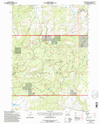
1992 Map of Drake Butte
USGS Topo · Published 1997About this map
Och Oco Mountains and the Maury Mountains dominate this 1990s terrain, where the landscape is defined by high ridges and a complex system of springs and stock ponds. The Drake Butte Lookout Tower stands as a prominent landmark on Drake Butte, overlooking a network of forest roads and drainages. The Crooked River cuts through the northern section of the map, while the southern reaches descend toward Antelope Reservoir.
Find a feature on this map
38 named features on this map. Tap any name to fly to it.
Don’t see what you’re looking for? This feature index may not catch every label — zoom into the map to look around manually.
Map Details
Editions of this 1992 Drake Butte Map
This is the sole edition of this map. No revisions or reprints were ever made.
Other maps of this area

1951 · Post
USGS Topo · 1:62,500

1955 · Crescent
USGS Topo · 1:250,000

1955 · Bend
USGS Topo · 1:250,000

1957 · Crescent
USGS Topo · 1:250,000

1957 · Bend
USGS Topo · 1:250,000

1958 · Crescent
USGS Topo · 1:250,000

1958 · Bend
USGS Topo · 1:250,000

1970 · Crescent
USGS Topo · 1:250,000

1981 · Prineville
USGS Topo · 1:100,000

1982 · Arrowwood Point
USGS Topo · 1:24,000