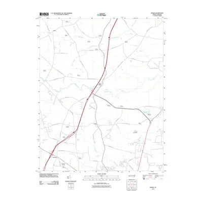
2010 Map of Drake
USGS Topo · Published 2010About this map
Dortches and Gold Rock anchor this North Carolina landscape, where the road network transitions from rural family farm routes to modern transport corridors. Numerous family burial grounds, including the Robinson Cemetery, Powell Cemetery, and Johnson Cemetery, are scattered across the terrain, offering significant evidence for genealogical research in this part of the state. The geography is defined by a dendritic drainage system where Swift Creek and its various tributaries like Beech Branch and Compass Creek wind through the countryside. Near the settlement of Drake, the map reveals the local water management through features such as Braswells Lake and the Fenners Pond Dam, reflecting the agrarian roots and small-scale water engineering of the region.
Find a feature on this map
61 named features on this map. Tap any name to fly to it.
Don’t see what you’re looking for? This feature index may not catch every label — zoom into the map to look around manually.
Map Details
Editions of this 2010 Drake Map
This is the sole edition of this map. No revisions or reprints were ever made.
Other maps of this area

1902 · Rocky Mount
USGS Topo · 1:62,500

1902 · Tarboro
USGS Topo · 1:62,500

1903 · Tarboro
USGS Topo · 1:62,500

1904 · Rocky Mount
USGS Topo · 1:62,500

1953 · Norfolk
USGS Topo · 1:250,000

1953 · Rocky Mount
USGS Topo · 1:250,000

1954 · Rocky Mount
USGS Topo · 1:250,000

1961 · Whitakers
USGS Topo · 1:24,000

1961 · Enfield
USGS Topo · 1:24,000

1963 · Ringwood
USGS Topo · 1:24,000