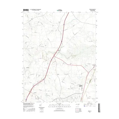
2016 Map of Drake
USGS Topo · Published 2016About this map
Salem and Gold Rock anchor the northern landscape of this rural landscape where numerous small family cemeteries like Robinson Cem and Dozier Cem are preserved among the fields. The terrain is defined by the drainages of Swift Creek and Compass Cr, which feed into local landmarks such as Fenners Pond and Braswells Lake. Settlement patterns follow the traditional road networks, with Dortches and Drake serving as local crossroads. To the southeast, the growing footprint of Rocky Mount is visible, including the campus of N Carolina Wesleyan Coll. This map documents the intersection of rural agriculture and emerging suburban corridors, bounded by the line between Nash Co and Edgecombe Co.
Find a feature on this map
94 named features on this map. Tap any name to fly to it.
Don’t see what you’re looking for? This feature index may not catch every label — zoom into the map to look around manually.
Map Details
Editions of this 2016 Drake Map
This is the sole edition of this map. No revisions or reprints were ever made.
Other maps of this area

1902 · Rocky Mount
USGS Topo · 1:62,500

1902 · Tarboro
USGS Topo · 1:62,500

1903 · Tarboro
USGS Topo · 1:62,500

1904 · Rocky Mount
USGS Topo · 1:62,500

1953 · Norfolk
USGS Topo · 1:250,000

1953 · Rocky Mount
USGS Topo · 1:250,000

1954 · Rocky Mount
USGS Topo · 1:250,000

1961 · Whitakers
USGS Topo · 1:24,000

1961 · Enfield
USGS Topo · 1:24,000

1963 · Ringwood
USGS Topo · 1:24,000