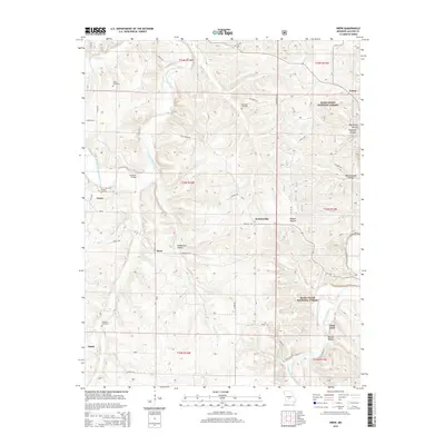
2015 Map of Drew
USGS Topo · Published 2015About this map
Osage Fork Gasconade River winds through this section of Missouri, anchoring a landscape defined by small rural settlements and extensive forestry. Small communities such as Drew, Jacksonville, and Lyons are scattered among the ridges and hollows, connected by a network of local roads like Braddock Rd and Scenic Dr. The area's history is preserved in its numerous family burial grounds, including Bohanon Cemetery and Heard Cemetery, which remain as markers of the families who settled this rugged terrain. Within the Mark Twain National Forest, the topography is deeply etched by features like Burnt Cabin Hollow and Flagmire Hollow, leading down to the Gasconade River near Clark Ford. Natural water sources like Blue Spring and Mayfield Spring provided vital resources for early homesteads in the Ozark highlands.
Find a feature on this map
51 named features on this map. Tap any name to fly to it.
Don’t see what you’re looking for? This feature index may not catch every label — zoom into the map to look around manually.
Map Details
Editions of this 2015 Drew Map
This is the sole edition of this map. No revisions or reprints were ever made.
Other maps of this area

1931 · Manes
USGS Topo · 1:48,000

1941 · Manes
USGS Topo · 1:62,500

1941 · Lebanon
USGS Topo · 1:62,500

1943 · Lebanon
USGS Topo · 1:62,500

1943 · Manes
USGS Topo · 1:62,500

1943 · Drynob
USGS Topo · 1:62,500

1954 · Springfield
USGS Topo · 1:250,000

1954 · Drynob
USGS Topo · 1:62,500

1954 · Drew
USGS Topo · 1:24,000
1954 · Winnipeg
USGS Topo · 1:24,000