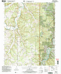
2004 Map of Drew
USGS Topo · Published 2006About this map
Laclede County's agricultural and forest lands are centered on the rural settlements of Drew and Falcon in this 2004 revision. The landscape is defined by the winding course of Osage Fork and the Gasconade River, where small family-named hollows like Wilcox Hollow and Flagmire Hollow cut into the plateau. Genealogists will find a wealth of local markers, including the New Home Cem and Porter Chapel, alongside several outlying burial sites like Stewart Cem and Heard Cem. The area maintains a deep connection to its past through identified landmarks such as Moots Store and the site of Franklin Sch, even as large portions of the eastern terrain are managed within the Mark Twain National Forest. Local navigation is marked by historical crossings such as Lambeth Bridge and the Clark Ford over the Gasconade.
Find a feature on this map
35 named features on this map. Tap any name to fly to it.
Don’t see what you’re looking for? This feature index may not catch every label — zoom into the map to look around manually.
Map Details
Editions of this 2004 Drew Map
This is the sole edition of this map. No revisions or reprints were ever made.
Other maps of this area

1931 · Manes
USGS Topo · 1:48,000

1941 · Manes
USGS Topo · 1:62,500

1941 · Lebanon
USGS Topo · 1:62,500

1943 · Lebanon
USGS Topo · 1:62,500

1943 · Manes
USGS Topo · 1:62,500

1943 · Drynob
USGS Topo · 1:62,500

1954 · Springfield
USGS Topo · 1:250,000

1954 · Drynob
USGS Topo · 1:62,500

1954 · Drew
USGS Topo · 1:24,000
1954 · Winnipeg
USGS Topo · 1:24,000