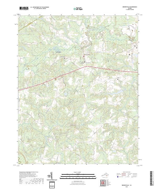
2022 Map of Drewryville
USGS Topo · Published 2022About this map
Drewryville and the nearby settlement of Arringdale serve as the primary landmarks in this coastal plain landscape along the Sussex and Southampton county line. The terrain is defined by a dense network of blackwater drainages and wooded wetlands, including Smith Swamp, Applewhite Swamp, and the interestingly named Belliache Swamp. These natural features dictated the early layout of regional transit, visible in the winding paths of Old Belfield Rd and Fortsville Rd as they navigate around the low-lying basins of Three Creek.
Find a feature on this map
50 named features on this map. Tap any name to fly to it.
Don’t see what you’re looking for? This feature index may not catch every label — zoom into the map to look around manually.
Map Details
Editions of this 2022 Drewryville Map
This is the sole edition of this map. No revisions or reprints were ever made.
Other maps of this area

1919 · Jarratt
USGS Topo · 1:62,500

1919 · Homeville
USGS Topo · 1:48,000

1919 · Boykins
USGS Topo · 1:48,000

1919 · Arringdale
USGS Topo · 1:48,000

1920 · Homeville
USGS Topo · 1:62,500

1920 · Boykins
USGS Topo · 1:62,500

1920 · Arringdale
USGS Topo · 1:62,500

1942 · Arringdale
USGS Topo · 1:62,500

1943 · Sebrell
USGS Topo · 1:31,680

1951 · Jarratt
USGS Topo · 1:62,500