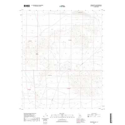
2018 Map of Drinkwater Lake
USGS Topo · Published 2018About this map
The Granite Mountains dominate the central terrain of this high desert landscape, providing a dramatic backdrop to the arid reaches of the Mojave Desert. This 2018 survey by the U.S. Geological Survey captures a region defined by its vital water sources and passage points. Critical hydrologic features such as Drinkwater Spring and Devouge Spring are meticulously recorded, alongside the seasonal Drinkwater Lake at the northern edge of the quadrangle. Transport through this area is anchored by Fort Irwin Rd, which winds through Granite Pass, a natural corridor between the desert flats and the surrounding peaks. The map provides a detailed view of the Public Land Survey System (PLSS) grid across townships T16N R3E and T15N R4E, offering a clear layout of the township and range divisions that define land management in this portion of San Bernardino County.
Find a feature on this map
11 named features on this map. Tap any name to fly to it.
Don’t see what you’re looking for? This feature index may not catch every label — zoom into the map to look around manually.
Map Details
Editions of this 2018 Drinkwater Lake Map
This is the sole edition of this map. No revisions or reprints were ever made.
Other maps of this area

1933 · Avawatz Mountains
USGS Topo · 1:250,000

1947 · Trona
USGS Topo · 1:250,000

1948 · Red Pass Lake
USGS Topo · 1:62,500

1948 · Trona
USGS Topo · 1:250,000

1948 · Leach Lake
USGS Topo · 1:62,500

1948 · Avawatz Pass
USGS Topo · 1:62,500

1948 · Tiefort Mountains
USGS Topo · 1:62,500

1951 · Tiefort Mountains
USGS Topo · 1:62,500

1951 · Avawatz Pass
USGS Topo · 1:62,500

1951 · Red Pass Lake
USGS Topo · 1:62,500