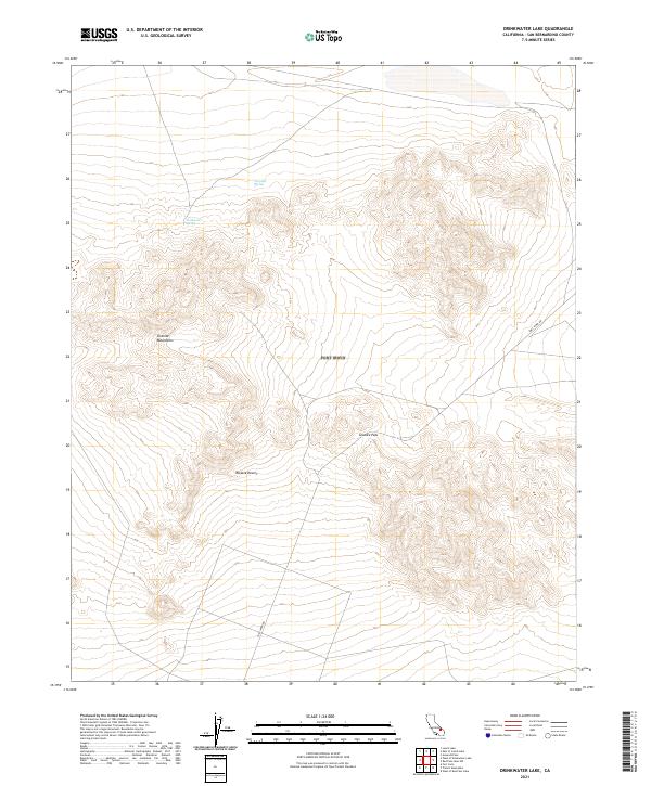
2021 Map of Drinkwater Lake
USGS Topo · Published 2021About this map
The Granite Mountains rise sharply above the floor of the Mojave Desert in this high-desert landscape within San Bernardino County. In an environment defined by extreme aridity, rare water sources like Drinkwater Spring and Devils Spring serve as critical landmarks for survival and navigation. The terrain is marked by the passage through Granite Pass, a natural corridor between the ridgelines that dictates the flow of travel through the region. Modern access is primarily facilitated by Fort Irwin Rd, which cuts through the southeastern portion of the quadrangle. This area reflects a classic desert topography where the rigid township and range lines of the Public Land Survey System, such as t16n r3e and t16n r4e, contrast with the complex, twisting contour lines of the rugged mountain elevations.
Find a feature on this map
10 named features on this map. Tap any name to fly to it.
Don’t see what you’re looking for? This feature index may not catch every label — zoom into the map to look around manually.
Map Details
Editions of this 2021 Drinkwater Lake Map
This is the sole edition of this map. No revisions or reprints were ever made.
Other maps of this area

1933 · Avawatz Mountains
USGS Topo · 1:250,000

1947 · Trona
USGS Topo · 1:250,000

1948 · Red Pass Lake
USGS Topo · 1:62,500

1948 · Trona
USGS Topo · 1:250,000

1948 · Leach Lake
USGS Topo · 1:62,500

1948 · Avawatz Pass
USGS Topo · 1:62,500

1948 · Tiefort Mountains
USGS Topo · 1:62,500

1951 · Tiefort Mountains
USGS Topo · 1:62,500

1951 · Avawatz Pass
USGS Topo · 1:62,500

1951 · Red Pass Lake
USGS Topo · 1:62,500