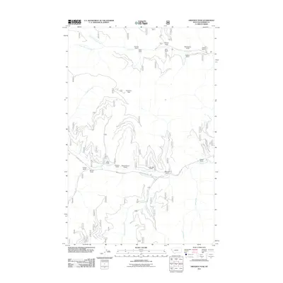
2011 Map of Driveway Peak
USGS Topo · Published 2011About this map
Driveway Peak towers over a complex network of drainages in this part of Sanders County, where the landscape is defined by the steep gullies and high ridges of the Bitterroot Range. The drainage patterns are particularly intricate, with Prospect Creek serving as a central artery for several named gulches, including Lucky Boy Gulch, Buster Brown Gulch, and Therriault Gulch. These evocative names suggest a history of prospecting and resource extraction that has long characterized this mountainous region of Montana.
Find a feature on this map
27 named features on this map. Tap any name to fly to it.
Don’t see what you’re looking for? This feature index may not catch every label — zoom into the map to look around manually.
Map Details
Editions of this 2011 Driveway Peak Map
This is the sole edition of this map. No revisions or reprints were ever made.
Other maps of this area

1914 · Avery
USGS Topo · 1:125,000

1917 · Avery
USGS Topo · 1:125,000

1918 · St Regis
USGS Topo · 1:125,000

1919 · St. Regis
USGS Topo · 1:125,000

1932 · Trout Creek
USGS Topo · 1:125,000

1935 · Trout Creek
USGS Topo · 1:125,000

1936 · Trout Creek
USGS Topo · 1:125,000

1937 · Thompson Falls
USGS Topo · 1:125,000

1937 · Thompson Falls
USGS Topo · 1:62,500

1956 · Cooper Gulch
USGS Topo · 1:62,500