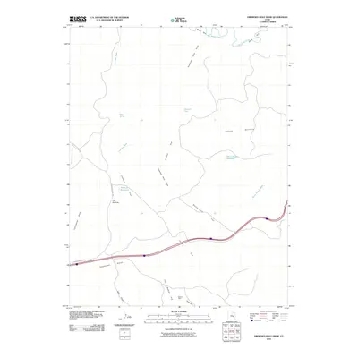
2010 Map of Drowned Hole Draw
USGS Topo · Published 2010About this map
The San Rafael River cuts through the northern reaches of this Emery County landscape, bordered by the steep enclosure of the Black Box. This high-desert terrain is defined by an intricate network of washes and flats, where seasonal water is managed through sites like Sinkhole Reservoir and Black Dragon Reservoir. Evidence of historical mineral exploration appears at the Brillian Mine near the southern boundary, situated between Cliff Dweller Flat and Hyde Draw.
Find a feature on this map
21 named features on this map. Tap any name to fly to it.
Don’t see what you’re looking for? This feature index may not catch every label — zoom into the map to look around manually.
Map Details
Editions of this 2010 Drowned Hole Draw Map
This is the sole edition of this map. No revisions or reprints were ever made.
Other maps of this area

1885 · San Rafael
USGS Topo · 1:250,000

1886 · Price River
USGS Topo · 1:250,000

1896 · Price River
USGS Topo · 1:250,000

1953 · Red Plateau SE
USGS Topo · 1:24,000

1953 · Tidwell 2 SW
USGS Topo · 1:24,000

1953 · Red Plateau SW
USGS Topo · 1:24,000

1953 · Beckwith Peak SW
USGS Topo · 1:24,000

1953 · Tidwell 2 NW
USGS Topo · 1:24,000

1954 · Stinking Spring Creek 1 SE
USGS Topo · 1:24,000

1954 · Stinking Spring Creek 1 NW
USGS Topo · 1:24,000